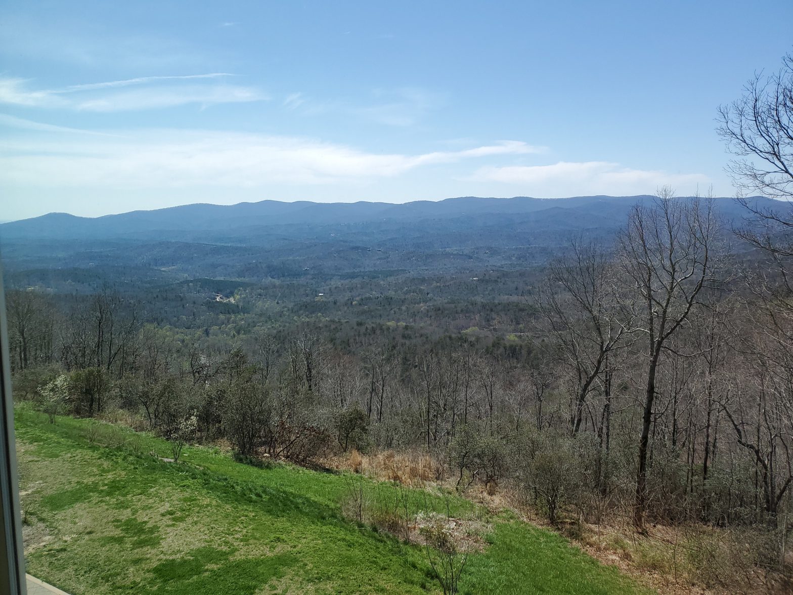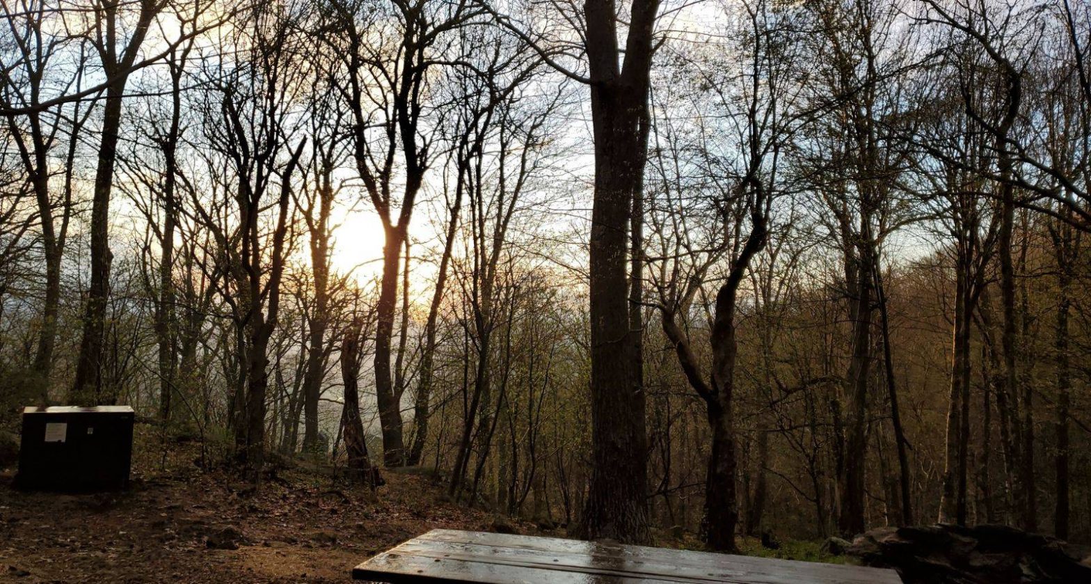
I found a sweet 20-mile loop on Alltrails that I just had to try. I planned on doing it as a 2-night trip but as always plans change. Friday evening after work I headed over to Fisher Gap, right in between Skyland and Big Meadows. I jumped on the AT and headed north towards Rock Spring Hut. I sprinted along the AT for a couple miles and just made it to the shelter before a rain shower set in. I greeted the folks I’d be sleeping with that night and set about routine things. The rain rolled out just before sunset. I managed to sleep for 12 hours. I couldn’t believe it, I must have needed it eh? The next morning I was up around 7am. Made breakfast and got moving. First stop, Hawksbill Mountain Summit a couple miles north and off on a spur trail. The featured image is from the summit. I got a nice shot of Byrd’s Nest as well. I ran down the mountain towards Upper Hawksbill parking lot, across Skyline Drive, to the Skyland-Big Meadows Horse Trail. I was on this trail for roughly 5 miles till I hit the north end of the Rose River loop. I ran some more through the Rose River loop till I came to Dark Hollow Falls. I took a break there, filtered water, and consumed plenty of water as well. Lots of day hikers here as well. I turned West and headed down a fire road that turned into Stoney Mountain Trail. I stopped about mid-way on this trail for lunch. I got moving again and popped out on the edge of the Rapidan Camp fire road. I turned and headed up the road towards Skyline drive. After walking the road for a while my GPS was telling me to turn left. As soon as I looked left I knew what trail it was telling to get on. It was the same horse trail that Tim, Dan, and I had conquered back in 2019. There was no way in hell that I was going to do that trail again. After further analysis of the map I surmised that I had already done the rest of the trail. So I kept going on the fire road till it brought me out to the back of the meadow at Big Meadows. I ran into a lot of day hikers, horseback riders, and dog walkers. Lots. I made it up and across the way to the wayside. Ran into some thru-hikers and chatted it up a bit. Then I head north and end up back at the truck a day early. According to my watch I did 2 miles Friday night and 17-1/2 miles on Saturday, within 8 hours, so I was strolling. My knees let me know about it for a week afterwards but it was worth it. I ended up loitering around Big Meadows lodge drinking beer, changing clothes and ‘bathing’ in a bathroom stall then having a nice dinner. There was no vacancy on the mountain so I booked a room in Manassas. It was beautiful driving down out of the mountains during the sunset.
All posts by Ed Carmine

MOONWOLF.IO
I just bought into a new crypto currency named Moonwolf.io. The token name is WOLF. The website is here: Moonwolf.io
*This is not financial advice.*
WAYNESBORO > SKYLAND LODGE
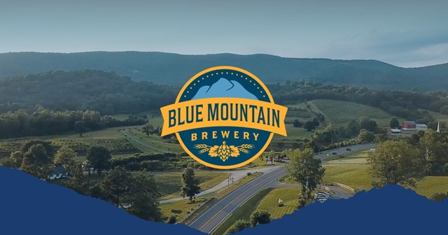
Day 12 – 60 miles – After breakfast and lounging at the hotel most of the morning we rolled out to Blue Mountain Brewery in Afton, VA for lunch and to stock up on take home beer. We left the brewery and headed north up Skyline Drive to Skyland Lodge for a night. We ran into a bear strolling down the middle of the road and Tim was able to capture some shots & a video of it. It was cool and overcast at Skyland but the lodge was busy. They gave us a preferred room and a fridge for our beer. We relaxed at the room and the lodge all day. After dinner we retired to our room and slept well.
WALASI-YI > FONTANA > THE DRAGON
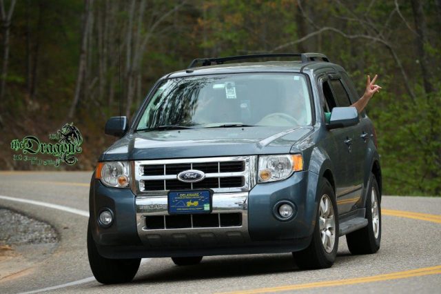
Day 11 – 528 miles -We were up early at the lodge. After breakfast we checked out and headed for Mountain Crossings at Neel gap to load up on merchandise we couldn’t get while hiking through. I bought a couple shirts, stickers, lunch, and few odds and ends. We chatted with a few hikers and were off to Fontana Dam. Fontana Dam, incidentally, is the tallest dam east of the Mississippi and is managed by the Tennessee Valley Authority. AT hikers cross this dam on their way to and from the Smokey mountains. After leaving Fontana Dam we got on Route 28 West and followed it along the river for a while. Tim started talking about the Tail of the Dragon of which I had no clue what he was talking about. He said he thinks we’re in the vicinity of some famous and deadly stretch of road. I’m like oh that’s cool… We pop out in Deals Gap on the NC/TN border. Home of the Dragon and consequently the Tail of said Dragon. A 11-mile stretch of road with no less than 318 curves within it. This road is so famous that we encountered multiple cameramen taking pictures of the vehicles that cruised this section. Over 1200 vehicles travel the tail every day. We saw a lot of VW tuner cars, motorcycles, sports cars, etc. We saw people trailing cars up just to run them on this road. I was kind of flabbergasted & pleased at the same time that something like this still exists in our whitewashed world. I ran the tail and survived to tell the… tale? :)) After running the through the Dragon tail we ended up on Foothills Parkway which is an 18-mile stretch with overlook stops that gaze onto the Smokeys. After the parkway we made our way towards I-40 then I-81 and north to Waynesboro, VA. for the night. The weather got to be terrible the last few hours of driving and I was exhausted when we finally rolled in to the hotel. Got a 2pm checkout and used it.